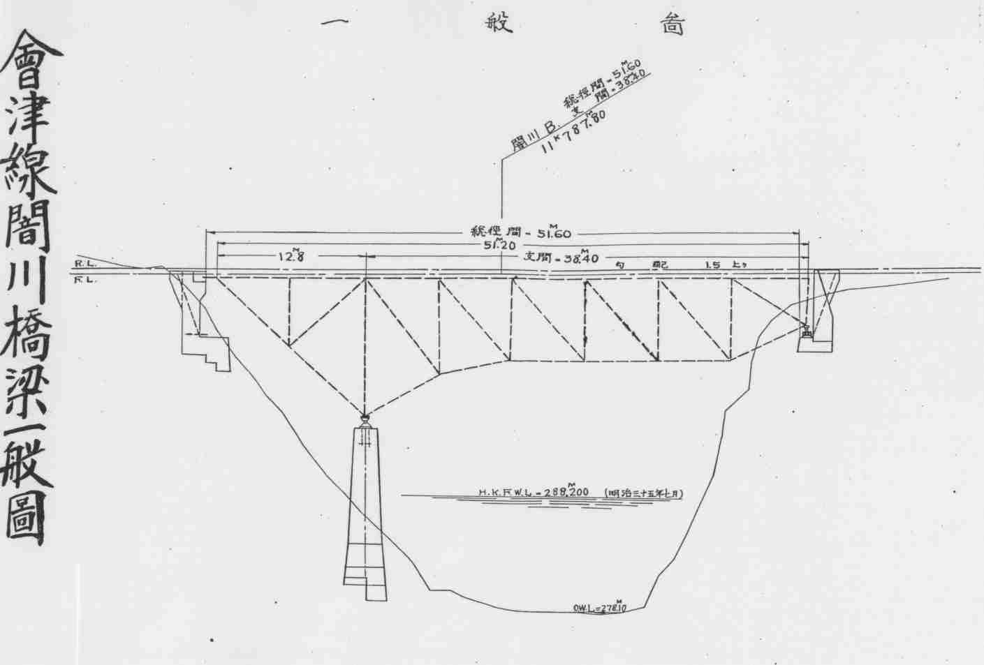
Description - 解説
Length - 全長: 51.8 m
2 spans of 12.8m + 38.4m. Pratt truss.
Opened in 1932 together with the Kamimiyori ~ Yunokami section of the Aizu Line.
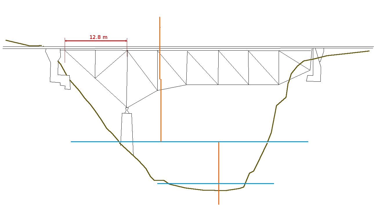
As the gorge of the Kuragawa River is quite deep, a pillar could not be built in the middle. As a result, it was built as a cantilever type bridge with a counterweight at one end. It was built by the Yokogawa Bridge Manufacturing Co. (now Yokogawa Bridge).
From the top of the rail to the top of the river at maximum depth is roughly 19.2 m or 63'. Most of the pictures I've seen the water level is much lower, around where the lower blue line on my sketch is. Estimating based on the outline of the gorge/riverbed on the diagram, which is in brown on my sketch, I'd say top of the rail to the river surface when the water is low is about 27 m or a bit over 88' 6".
Immediately adjacent was a concrete-arch road bridge (later replaced).
2つスパンがあるのプラットトラス橋梁である、一番目スパンの長さは12.8m、二番目のは38.4mである。
橋梁は上三寄駅から湯野上駅までの線路と一緒に開かれた。
闇川の峡谷の深さおかげで柱は川の半ばで構築できなかった。結果的に橋梁は一端でカウンターウエイトのあるのカンチレバー橋として構築された。橋梁は横河橋梁製作所(現:横河ブリッジ)によって建てられた。
レールの頂上から最高水位での川面まで距離はおよそ19.2mである。私が見た写真で水位ははるかに低いであった、下の図面にての青の線の周りである。図面にての峡谷の外形から見積もり低い水位の時にてレールの頂上から川面まで距離はおよそ27mである。
鉄道橋のすぐ隣でコンクリート製のアーチ式道路橋があった、後でこれは交換された。
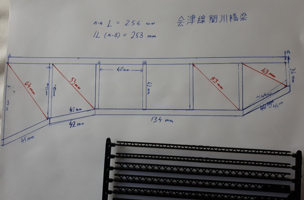
Partial diagram in N scale (1:150). 部分的な図面(縮尺1:150)。
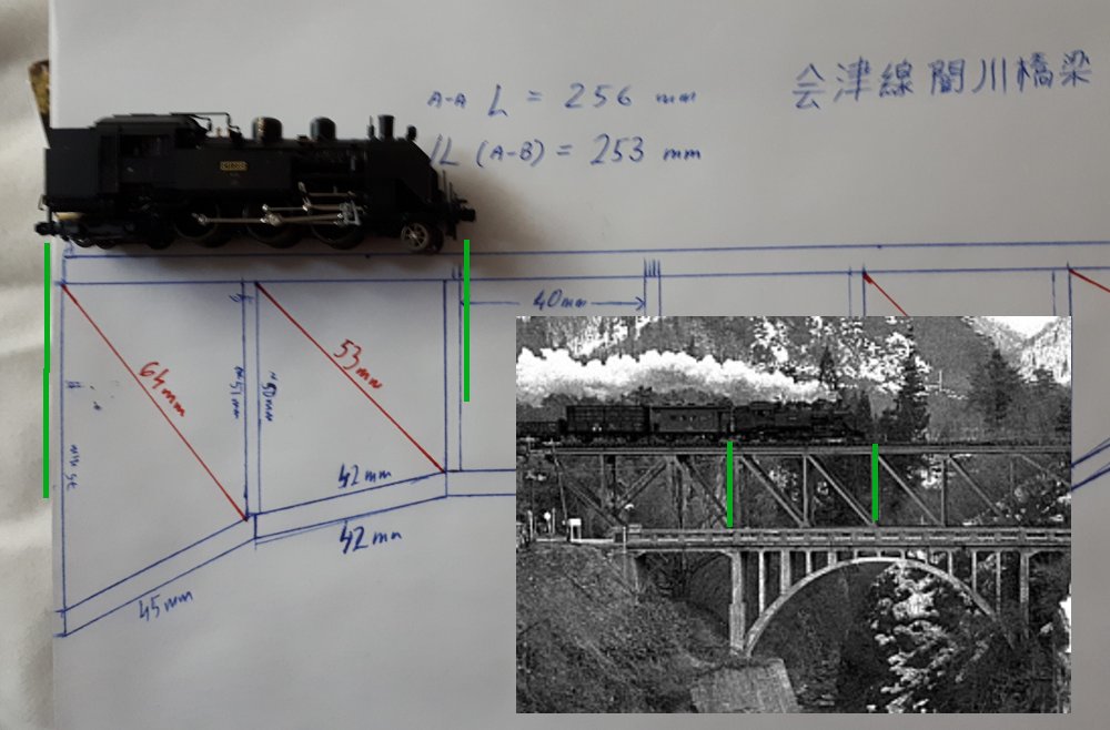
Partial diagram in N scale with C11 to illustrate size. 大小を説明するC11の模型と一緒に部分的な図面。

Overhead view of the bridge as it is today; very little has changed since the 1970s, aside from the road bridge having been replaced. 橋梁の現在の空撮。道路橋の交換を除いてほとんど変わらない。